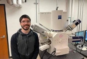
Angela Stetson Master's Candidate

Titled "Orphan Basalts: Investigating the Petrogenesis of Unassigned Eastern Oregon Basalts," my thesis project is focused on detailing the origins of basalts mapped within the Telephone Butte, Calamity Butte and Craft Point quadrangles located along the boundary between the Harney Basin and the southern foothills of the Blue Mountains Province. Named for the localities in which basalt samples were collected, several basalt units are mapped in each quadrangle. Similarities in geochemical analyses of each basalt unit suggest that although these basalts have different unit names, they are in fact related and likely originated from the same source. 

Read More

Alyssa Smith PhD candidate

My research is focused in the central to northern Oregon Cascade Range. In this part of the Cascade Range, erupted lavas are very compositionally restricted as compared to other arc segments. Although the central to northern Oregon Cascade Range does have several large, more andesitic stratovolcanoes, such as Mt. Hood, Mt. Jefferson, and the Middle and South Sister, volcanism is dominated by hundreds of smaller, basaltic volcanoes. Studies of the Cascade Range have acknowledged the prevalence of basaltic volcanism in this portion of the range, but many regional studies have focused on the andesitic centers, leaving most of the basaltic centers unstudied. 

Read More

Lizzet Reyes Master's Candidate

Volcanic eruptions release carbon dioxide (CO2) into the atmosphere, which contributes to the carbon cycle. However, much is still unexplored about how volcanic eruptions affect the movement of organic carbon from vegetation and soil. My thesis focuses on the impact of the 1980 Mount St. Helens eruption on the terrestrial carbon cycle. It examines how the eruption affected carbon storage in vegetation and soils in the affected area. By comparing terrestrial carbon levels before and after the eruption, we aim to establish a carbon budget for the period since 1980. 

Read More

Obinna Ozioko PhD candidate

Temporal clustering of deep-seated landslides in the Puget Lowlands; a seismic trigger? 

The Puget Lowlands of Washington State is about the most seismically active region in the Pacific Northwest. Paleoseismic records show ample evidence of prehistoric crustal and Cascadia megathrust earthquakes in the region with a temporal cluster of earthquakes in the crustal faults about 1000 years ago. Although multiple paleoseismic records exist for crustal and Cascadia megathrust earthquakes in the area, little is known about the temporal and spatial distribution of earthquake-triggered landslides. To address this, we conducted a comprehensive study applying surface roughness age dating techniques to over 600 landslides in the lower Puget Sound region to explore earthquake-triggered landslides' spatial and temporal patterns. 

Read More
Brett Hopt Master's Candidate

Black shales are rocks that are enriched in heavy metals and metalloids. Previous studies have shown that agriculture crops grown on soils formed on black shales pose a health hazard to humans and biota. However, no study has been conducted on the environmental hazard that these outcrops may pose in watersheds with black shale outcrops. I will be studying how these heavy metals are partitioned in streams once released during weathering; heightened knowledge is needed in this area so that state agencies may better protect human and environmental health in areas where metalliferous black shales occur. 

Read More

Javaria Aziz Master's Candidate

My master’s thesis focuses on understanding magma evolution and eruptive history of Three Fingered Jack, a dissected mafic composite cone volcano in the central High Cascades of Oregon. This region is characterized by intra-arc extension, creating an extensive mafic platform dominated by dozens of small scoria cones and voluminous mafic flows of basaltic and basaltic andesitic composition. It has the largest concentration of mafic monogenetic volcanoes in the entire Cascade arc, some of which have erupted in the past 2,500 years. Three Fingered Jack is much larger compared to its neighboring scoria cones.

Read More

George Anim Master’s Candidate

My research is focused on understanding shock deformation in shergottites, the most commonly sampled Martian meteorites. My goals are to estimate deformation intensities in shergottites, identify the number of asteroid impact events they have undergone, and develop additional deformation estimation criteria based on changes in the crystal structure of key minerals such as olivine and pyroxene. Understanding the shock deformation in shergottites (and, by extension, all Martian meteorites) will allow for an unbiased interpretation of primary features that can reveal a lot about the geologic processes that shaped Mars.

Read More

GSOC Crowd Enjoyed the Annual Picnic at Beacon Rock SP

GSOC Crowd Enjoyed the Annual Picnic at Beacon Rock SP

The GSOC Annual Picnic enjoyed a good turnout this year at Beacon Rock State Park in the Columbia River Gorge. GSOC had not sited the picnic here for over 20 years, and members agreed that this was a very good venue for a picnic. Not only did the site have a serviceable enclosed shelter building, but also a great view of some outstanding geology – Beacon Rock, a remnant of the last known outpouring of Boring lava, dated at 58,000 years ago.

Read More

Lab Work on Mafic Dikes Will Reveal Magma Storage Depth

Lab Work on Mafic Dikes Will Reveal Magma Storage Depth

Vogt Scholar Rachel Sweeten reports: “This year we were able to successfully locate another ~30 dikes as well as a potential layered mafic intrusion exposure (middle photo) with an inferred 600 cubic km volume. Lab work will continue this fall and winter in the form of clinopyroxene thermobarometry (to determine storage depth) as well as the full suite of XRF [X-ray fluorescence] and ICPMS [Inductively Coupled Plasma Mass Spectrometry] analysis of all new samples.” Photo on right is of field assistant Heather Ziff next to a large boulder of the upper portion of the layered intrusion that fell to the bottom of the slope as a result of a rockfall.

Read More

A Unique Dunite Clast in a Lunar Meteorite

A Unique Dunite Clast in a Lunar Meteorite

Vogt Scholar Daniel Sheikh reports: “I recently had the opportunity to present some of my research at the 85th Annual Meeting of the Meteoritical Society, held in Glasgow in August. In this talk, I presented on a unique dunite clast (photo left) found within one of my lunar meteorite samples for research, and implications on how it likely formed. This is a component of the larger research focus that I am involved in, which is to constrain the range of lunar lithologies found in lithic clasts from lunar meteorites and to characterize the degree of shock deformation imposed on each of them.”

Read More

Examining Magma History from Grains of Olivine

Examining Magma History from Grains of Olivine

Vogt Scholar Darlene Gilroy reports: “I am currently in the picking stage of lab work. In this stage, I am using a microscope to look at crushed scoria and “pick” out specific grains of olivine. The scoria is from the Boring Volcanic Mt. Tabor. After finishing the Mount Tabor samples I will move on to my other sample sites, also Boring Volcanic: Prune Hill, Mount Scott, and Battle Ground Lake. The olivine grains will be mounted in epoxy and sent off for electron microprobe and Fourier-transform infrared spectroscopy to establish the rate of ascent and storage depth of magma for the Boring volcanics. I recently sent samples from all four locations to WSU for bulk geochemical analysis.”
(Photo left: Darlene and retired DOGAMI geologist/GSOCer Ian Madin at her Mt. Tabor field site reconning for our 2023 Boring Buttes field trip. Photo right: view under a microscope showing olivine which are the “amber colored” grains among the darker scoria. )

Read More

Preparing Central/Eastern Oregon Glass for Mass Spectrometry

Preparing Central/Eastern Oregon Glass for Mass Spectrometry

Vogt Scholar Julian Cohen reports: “I completed my field work over 11 days at the end of August and collected around 30 glass samples from various places all over central and eastern Oregon. Since then, I’ve been working to prepare them for mass spectrometry analysis by crushing, sieving, and cleaning the glass shards. Photo (left) is of some relatively “clean” glass, meaning there aren’t a lot of surface precipitates on it that might impact the analysis. I’ll have to run many samples through a series of acid washes to clean the shards to insure there isn’t contamination! I’ll be at the University of Texas Austin in December to do my analyses.”

Read More
The Big Kapow! Crater Lake Field Trip Recap

The Big Kapow! Crater Lake Field Trip Recap

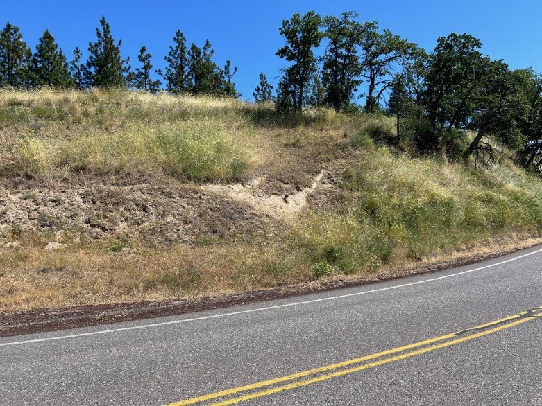
This trip began in the mind of GSOC member Dr. Benjamin Sloan after he joined the society last year and participated in the Coaledo trip last summer. By September he was emailing me and asking whether we would consider doing a trip to Crater Lake. I replied that we’d consider the trip, then added a long list of logistical considerations that needed to be worked out, thinking that would be the last I’d hear from him. Well, one month later he had researched the technical papers, gone to Crater Lake to research lodging and travel routes, and sent me a list of tasks he’d completed. Turns out that Ben has been planning field trips worldwide and teaching geology for years as well as doing oil exploration.

Read More

GSOC Strawberry Mountain Field Trip

GSOC Strawberry Mountain Field Trip

story text by Carole Miles

photos by Carole Miles, Denny Chamberlin, and Kate Ely

The Strawberry Mountain fault was discovered in 2019 by DOGAMI’s Ian Madin upon reviewing new LiDAR maps of the area. Andrew Dunning, looking for a project for his master’s thesis at Portland State University, realized that a lack of high-quality seismic data in this area of Oregon may have erroneously led to an inaccurate assessment of the seismic risk in Eastern Oregon on the USGS National Seismic Hazard Map. He has been working on gathering data related to timing and offset of the Strawberry Mountain fault for the past two years. He was excited to take GSOC members into the field to show us what he has learned.

Read More

Willamette East Bank Bike Geotour Recap and DIY Field Trip

Willamette East Bank Bike Geotour Recap and DIY Field Trip

Recap of the GSOC Willamette East Bank Bike Geotour - June 26, 2022

GSOC participants of the 3rd Eastbank Bike Geotour field trip met on the morning of Sunday, June 26, in order to complete the tour before the 90+ degree temperatures of the hottest day of the year (so far) set in. This tour had not been run in three years due to the pandemic, and the leaders included Ian Madin, who just retired from DOGAMI, and Dr. Lalo Guerrero, who teaches geology at Portland Community College. Take a journey with the group and think about biking it for yourself!

Read More

Fluvial Processes in the Willamette Valley

Fluvial Processes in the Willamette Valley

Recap of the GSOC Willamette Valley Transect Geotour - June 18, 2022

Thirteen happy participants of 2022’s first GSOC field trip piled into the back room of the Bear Creek Pizza parlor in Molalla this past Saturday night to eat dinner and sketch up their conclusions from the day’s journey across the Willamette Valley. GSOC Past President and Programming Director Sheila Alfsen led the group from Erratic Rock State Park on the west side of the valley to the Molalla Rosette to the east of the valley in more or less a straight line. The purpose of the trip was to observe the landforms of the Willamette Valley, concentrating on the fluvial processes at work in the sediments of the valley floor.

Read More