From Bowlby to Zumwalt: Exploring the Geology of Oregon's Wallowas
/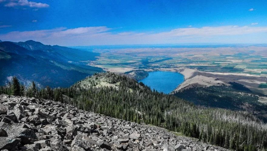
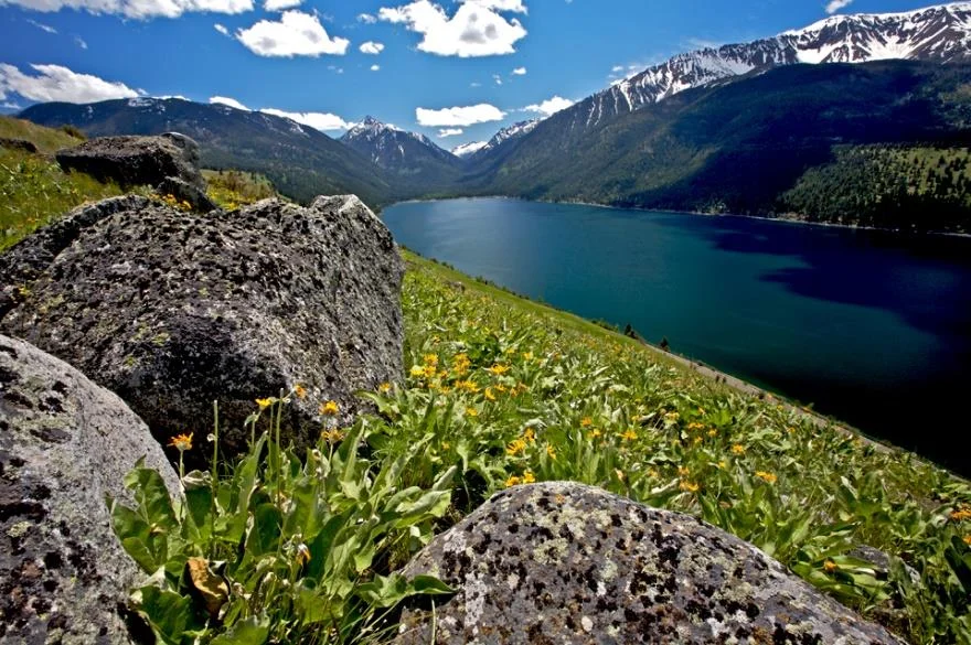
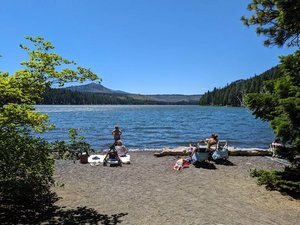
Wallowa Lake at the base of the Wallowa Mountains near Enterprise, Oregon. Photo by Ellen Morris Bishop.
The Short Geologic History of the Wallowa Mountains and Hells Canyon
Synopsis of the GSOC 83rd Annual Banquet lecture given on March 11, 2018, with speaker Dr. Ellen Morris Bishop
Dr. Ellen Morris Bishop – geologist, writer, and photographer – drove from her ranch near Enterprise, Oregon, to speak to an enthusiastic GSOC audience at the 83rd Annual Banquet on Sunday, March 11, 2018. The purpose of her talk was to introduce GSOCers to the geology of Oregon’s Wallowa Mountains and Hells Canyon (WMHC).
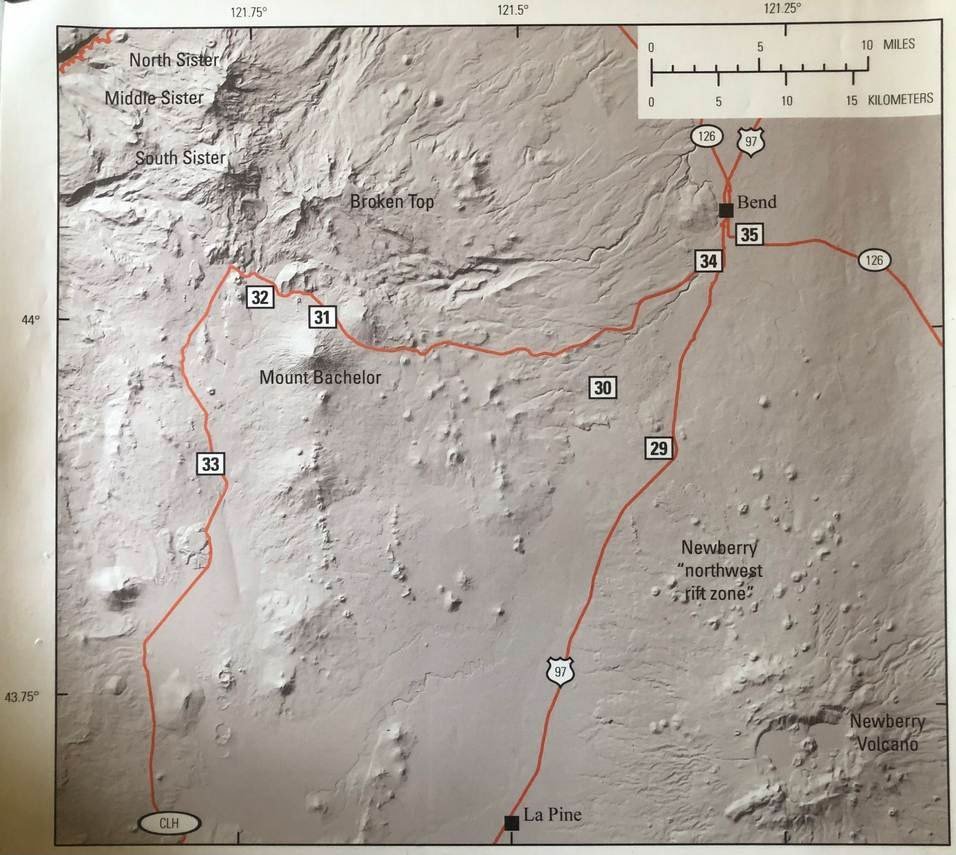
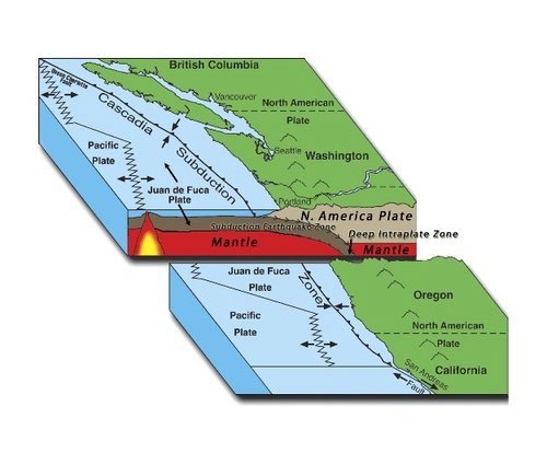
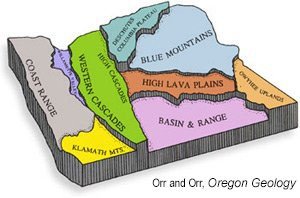
Bishop began by showing the location of WMHC on a terrain enhanced road map of Oregon, then a satellite view, and finally a geologic overview as depicted by the Oregon Department of Geology and Mineral Industries’ (DOGAMI’s) online interactive map. Studying the DOGAMI map one sees that the bulk of the Wallowa Mountains consists of outcrops of the “Wallowa Terrane” and “Nevadan Intrusives”, which can both be viewed as a result of the docking of ancient island complexes to the North American continent by the mechanism of plate subduction.
Stratigraphy schematic of the Wallowa Mountains and Hells Canyon area. Photo by Ellen Morris Bishop.
The rocks of the Wallowa Terrane, ranging from 295 million years (Ma) to 160 Ma in age, outcrop in the eastern and southern regions of the Wallowa Mountains and in the depths of Hells Canyon. They are themselves the island complex materials which docked to the North American continent. The Wallowa Batholith, labeled “Nevadan Intrusives” on the map, is the result of an upwelling of mantle plume, facilitated by the breaking off of the subducting oceanic plate which occurred as a result of the docking of the Wallowa Terrane. The mantle plume injected magma into the continental crust into what is now the western region of the Wallowa Mountains, where it cooled below the surface of the continent, and later became exposed by uplifting and erosion. These rocks are about 130 Ma in age. Another fact about the docking of the Wallowa Terrane is that it caused the buildup of very high mountains, similar to the Himalayas today.
Surrounding, capping, and cutting through these ancient rocks are the Columbia River Basalts (CRB) from the Miocene Epoch. These started erupting about 17 Ma through vents in the Wallowas and nearby regions. The CRB flows completely inundated the area that is now the Wallowa Mountains because the tall mountains from the docking epoch had eroded and the terrain was relatively flat.
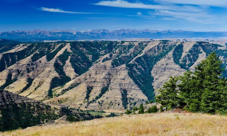
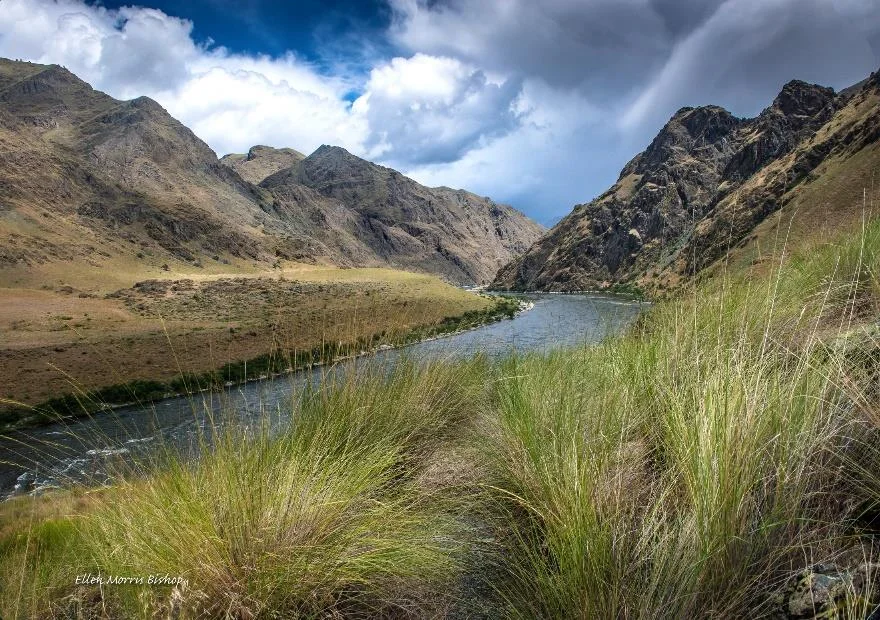
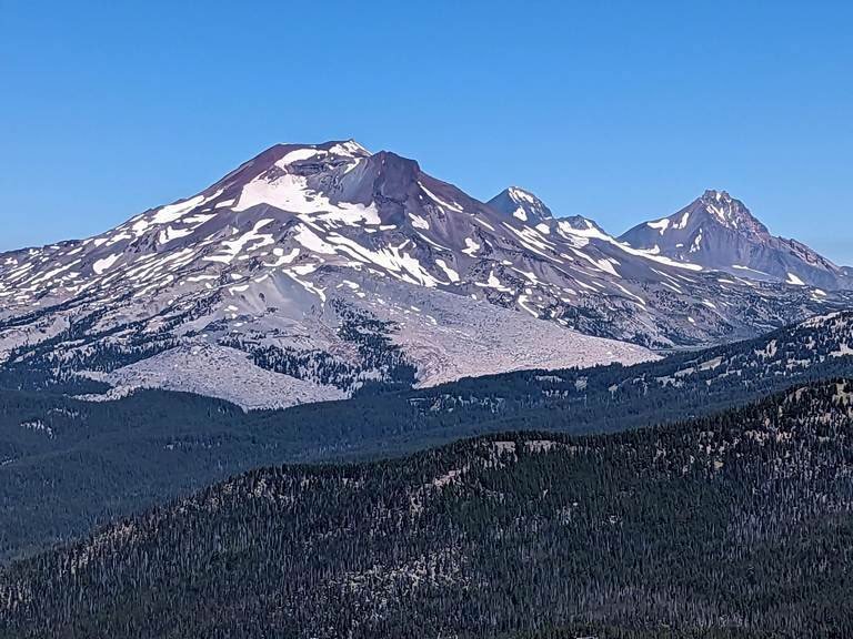
Hells Canyon looking southwest to the Zumwalt Prairie and Wallowa Mountains beyond. Photo by Ellen Morris Bishop.
The removal of the dense continental basement with the eruption of the CRB and the peeling of the remnants of the subducted Farallon tectonic plate beneath the Wallowas increased the buoyancy of the region, and the uplift which resulted in the Wallowa Mountains began. There has been more than 6000 feet of uplift in the last 14 Ma. These mountains were subject to local glaciation during the Pleistocene and Holocene Ice Ages, with some classic moraines deposited at their termini. Also, a single Ice Age flood pulse from Pleistocene Lake Bonneville tore through Hells Canyon, widening it and depositing some impressive gravel bars.
Bishop told the GSOC audience that folks from Wallowa County like to think of their county in terms of superlatives. The Wapshilla Ridge Unit of the Grande Ronde Flow of CRB originated in Wallowa County and is the most voluminous flow of basalt of the CRB. Likewise, the flood pulse from Lake Bonneville which widened Hells Canyon had a volume greater than that of any individual Missoula flood volume. Hell’s Canyon is North America’s deepest gorge.
At this point Bishop invited folks who were so inclined to get out there and enjoy the beautiful spring day, saying that this was the history of the area in a nutshell and the rest was just details. Nobody took her up on that!
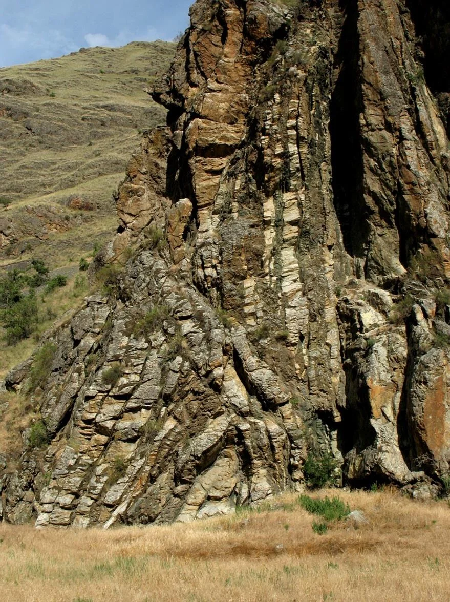
Alternating bands of andesite and rhyolite from the Cougar Creek Complex. Photo by Ellen Morris Bishop.
The Wallowa Terrane: a More In-depth View
After going through a general description of the Wallowas’ geology, complete with an illustration of the stratigraphic column, Bishop then proceeded to talk about details of the area and illustrate these with some of her own professional photography. She began with various sections of the Wallowa Terrane, a stratigraphic sequence of gneiss and mylonite, greenstone, marble/limestone, sandstone and shale ranging in age from 295 to 160 Ma.
The Wallowa Terrane’s oldest rocks are exposed only in Hells Canyon at Kirkwood Ranch. These heavily folded rocks of the Cougar Creek Complex are alternating bands of andesite and rhyolite and are 280 Ma. They were Permian volcanic rocks which have not been altered beyond recognition.
A slide of the volcanic island of Mt. Bromo on Java was shown as a modern example of the environment which created the Triassic basaltic greenstones found at the base of Mt. Bonneville, dating 230 Ma. Exposures include the Wild Sheep Creek Formation, which forms some of the most rugged and forbidding scenes in the depths of Hells Canyon. Some of these rocks are breccias from explosive volcanoes. Pillow basalts are exposed in places and Bishop showed a slide of pillows that were carried down the Snake River. Some greenstones are also found in the northern base of the Wallowa Mountains.
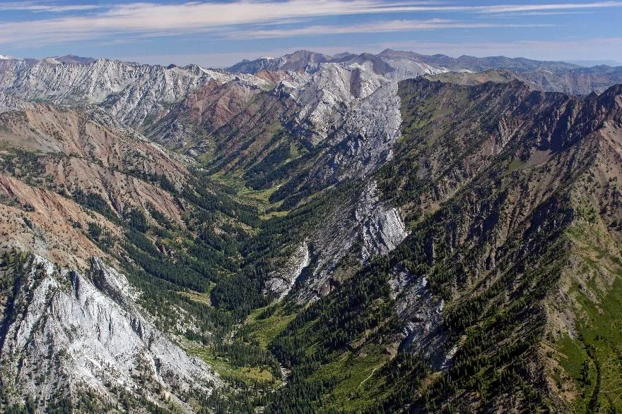
The walls of Eagle Creek Canyon are papered with alternating bands limestone and sandstone from the Martin Bridge and Hurwal Formations. Photo by Ellen Morris Bishop.
The Martin Bridge Formation consists of sedimentary limestones and marbles which are remnants of reefs and sediments from the Late Triassic. A well-known Ichthyosaur fossil was found in Eagle Creek by a high school student. A separate source from this lecture describes this formation as being “deposited in a narrow, carbonate-dominated basin during a lull in volcanic activity.”[1]
Sacajawea Peak, the highest peak in the Wallowas, is made from limestone and marble of the Martin Bridge Formation. Bishop explained that younger intruding granitic rock accomplished the transformation of limestone to marble in the Martin Bridge. Bishop showed a slide of an aerial view which contained both Martin Bridge Limestone and the Early Jurassic Hurwal Formation. Another slide of Eagle Creek showed dramatic banding between the Martin Bridge and Hurwal layers.
The Early Jurassic Hurwal Formation represents a deepening of the water which formed the reef platform of the Martin Bridge Formation. It includes sandstones and mudstones and volcanically derived sediments. Bishop showed slides of rocks from this age containing thinly bedded limestones and sandstones, the remnants of eroding volcanoes alternating with reef growth and found in Hurricane Creek. At the Black Marble Quarry near Enterprise, the quarry walls contain fossils of giant clams 5 to 10 inches long, which had chambered “wings,” allowing it to float in gooey muddy water.
Another group of sediments, the Middle Jurassic Coon Hollow Formation at Pittsburgh Landing contains temperate fern fossils, indicative of a shoreline setting.
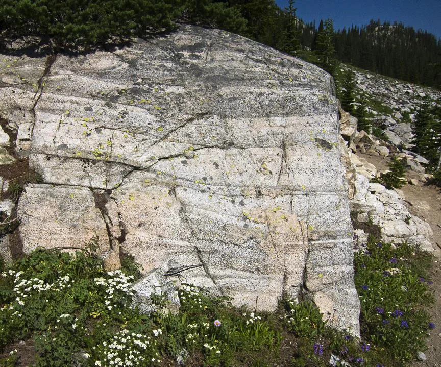
Banded granodiorite in the Wallowa batholith. Photo by Ellen Morris Bishop.
The Wallowa Batholith
At the core of the Wallowas, Bishop reiterated that collision uplift created very high mountains, and plutons formed from magma upwelling into the collision zone. Four different similarly aged granodiorite plutons can be found in the area, 100 Ma to 125 Ma. Bands in granitic rocks occur at the edge of the plutons. Eagle Cap peak is about 100 Ma and is formed of intrusive granite.
Of the geology between the Wallowa Batholith intrusion and the Columbia River Basalt floods, remains are skimpy and studies of them are skimpier. In 1991 John Eliot Allen wrote an article designed to stimulate interest in the subject in Oregon Geology. He described Pre-CRB river gravels containing giant quartzite boulders in the area on the Jim White Ridge Placer Mine.
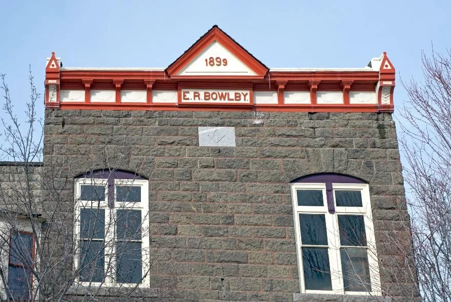
Bowlby Stone on the Bowlby Building in Enterprise was created in the Wapshilla Ridge flow. Photo by Ellen Morris Bishop.
Columbia River Basalts (CRB)
By the time the CRB started erupting the big mountains were gone, and the topography was relatively gentle. In a shot from the Buckhorn overlook, Bishop showed the audience that the CRB goes on forever, flow after flow after flow. The view represents the whole sequence of CRB flows. Bishop showed several photos of dikes in the Wallowas which produced the flood basalts - at Hurricane Creek, Wanapum dikes where Lewiston Highway crosses Grande Ronde river, and an aerial view showing extent of some of these dikes, 25 to 30 miles long.
Bishop also showed slides of the enormous 40 foot-wide dike near Maxwell Lake, which produced the Wapshilla Ridge Member of the Grande Ronde Basalt 16.2 Ma. Bishop avers that this is the most voluminous basalt flow on the planet. The flow volume totaled 9000 cubic miles, at a rate of 10 cubic miles per day. In a slide of Multnomah falls, Bishop pointed out the Wapshilla Ridge flow as the second from the top. Outcrops of this flow also occur as far as the Oregon coast, including Saddle Mountain in the Coast Range and Humbug Mountain on the coast.
Glacial moraines and erratic boulders from the shores of Wallowa Lake. Photo by Ellen Morris Bishop.
Bishop briefly spoke of Findley Buttes in Zumwalt Prairie north of Enterprise. They are located in the Zumwalt Prairie Preserve, owned by The Nature Conservancy. They are little shield volcanoes that are remnants of the Wapshilla Ridge eruption. The Bowlby Building in Enterprise was built in 1899 out of tuff related to the Wapshilla Ridge eruption.
Interesting climatic variations occurred during this time. Carbon dioxide produced by the CRB eruptions warmed the atmosphere by the greenhouse effect until the Wapshilla Ridge flow; then, an abundant disgorge of sulfur dioxide and particulates cooled things down.
Nowadays the remnants of the CRB eruptions just top the Wallowa Peaks, due to uplift of this area by 6000 feet in the last 14 Ma., and the eroding forces of glaciers, especially during the Ice Ages. The top of Twin Peaks is tipped with Imnaha Basalt, the oldest of the CRB flows. How and why did the Wallowas rise? The latest accepted theories say they had their dense root removed at the time of the CRB eruptions by delamination of the subducting Farallon plate. Researchers at UO are working on confirming the timing of the uplift and the flood basalts to confirm their theories on these processes.
Gravel bar dumped in Hells Canyon by the flood created by Ice Age Lake Bonneville. Photo by Ellen Morris Bishop.
The Ice Ages
After all the discussions about the accreted terranes, batholith formation, flood basalts, and uplift there was barely time for Bishop to explore the effects of the Ice Age valley glaciers which shaped the terrain of the Wallowas today. Bishop showed a lidar view of Wallowa Lake, with its classic moraines forming its shapely crescent 19,000 years ago. She also showed a slide of the large gravel bar formed in Hells Canyon by the massive flood produced by Pleistocene Lake Bonneville in a one-time event.
At the end of this memorable talk Bishop reminded the audience that all these geologic splendors are within a day’s drive from Portland, and she invited GSOCers to come on out and explore!
References and Additional Reading
Ellen Morris Bishop, Living with Thunder, Oregon State University Press, 2014. Author's note: I did a lot of fact-checking of my lecture notes with this most recently written volume by Bishop. A lot of the photos from Bishop’s slide show are also to be found in this book.
John Eliot Allen, “The case of the inverted auriferous paleotorrent-exotic quartzite gravels on Wallowa Mountain peaks,” Oregon Geology, Volume 53, Number 5, September 1991. This is the Allen article referred to in this article.
George D. Stanley Jr., Christopher A. McRoberts, Michael T. Whalen, “Stratigraphy of the Triassic Martin Bridge Formation, Wallowa terrane: Stratigraphy and depositional setting,” The Geological Society of America, Special Paper 442, 2008. Very detailed article about the MBF which is very prominent in the Wallowas.
[1] T. L. Vallier (Edited By) and H.C. Brooks, “Geology of the Blue Mountains region of Oregon, Idaho, and Washington; stratigraphy, physiography, and mineral resources of the Blue Mountains region,” USGS Professional Paper 1439, 1994. https://pubs.er.usgs.gov/publication/pp1439
Geology of the Wallowa Mountains Oregon, simplified geology map of the Wallowas by Andy Buddington, Earth Sciences Instructor at Spokane Community College.
Geologic units in Wallowa County, Oregon, web page on the USGS website.
Accreted Terranes & the Western Idaho Suture Zone, a web page in Digital Geology of Idaho website, By Keegan Schmidt, Lewis & Clark State College and Paul Link, Idaho State University. Lots of interesting photos of the topics in this lecture.


Field Trip Director
Annual Newsletter Editor
fieldtrips@gsoc.org